
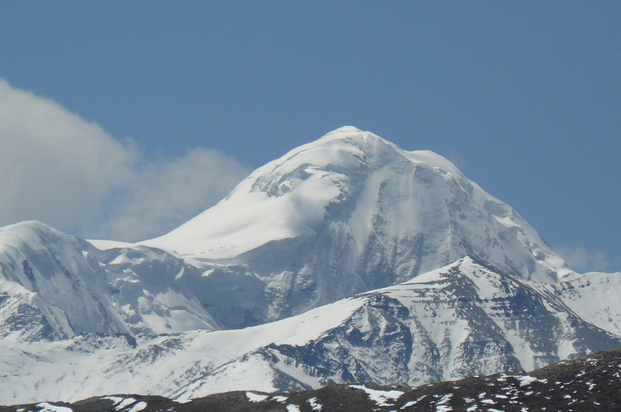
Danphesail peak 6103m is the Northernmost peaks in Dolpo, situated on the border between China and Nepal is a borderline peak. Danphesail peak is clearly visible in Himalayan Companion’s, Dolpo Jomsom Trek , Dolpo Immersion Trek and Upper Dolpo Rara Trek on the way between Shey to Bhijer.
SADAO YOSHINAGA an explorer and mountaineers from Japan had explored the West Nepal’s least known mountains in 1997 -2000.
SADAO YOSHINAGA (Osaka Alpine Club) - Exploring the Nepal’s least known Mountain of West Nepal
SADAO YOSHINAGA mentioned in his article – Danphesail peak (6103m) was used as mountain guide by Japanese Buddhist priest EKAI GUWAGUCHI on his way to Tibet.
‘Daphe, Sail (6103m) is on the border and its northern highest point (exceeding 6500 m), is located 1.7 km north of Daphe Sail itself and clearly in Tibet. These two peaks are seen from the south completely overlapped and as a single peak on the border. We were able to distinguish them clearly from three directions, E (from Lung Chung Kamo Bhangjyang), S (from track between Shey and Phijor) and SW (from the way above Poe). In 1900, a Japanese Buddhist priest Ekai Kawaguchi entered Tibet by a pass in Dolpo. On his famous book "Three Years in Tibet", he narrated that he proceeded to observe a mountain as a guide. This remarkable peak was once considered as Kawaguchi's "a mountain as a guide" on his way to Tibet. However, we are still in the labyrinth to know by which pass in Dolpo he smuggled himself into Tibet on 4 July 1900 just a hundred years ago.’
Danphesail Peak is looking like the Matterhorn of Wallis, Switzerland;
A rocky unnamed peak (6024 m, E83, 08, 31, N29 39 37), located to the E of Lung Chung Kamo Bhanjyan (5393 m, E83 07 47, N29 37 15) in the eastern part of Palchung Hamga Himal, was climbed to get the last and a full panoramic view from the summit. Although three eastern most passes were omitted in the program, we left our footprints on seven passes among two mountain ranges, The westernmost pass on the border, which is scarcely known even among the locals, was abandoned because of the difficulty to access from the south. However, this isolated pass is considered the most desirable approach from the east to Daphe Sail or highest peak of Palchung Hamga Himal. Here we have to mention about the correct topography of Daphe Sail (6103 m). This peak above named and other higher peaks of the range are surely on the boundary and the border line goes through westward along the great water divide. However, this peak seem to be the highest of Palchung Hamga Himal, as seen from the south, just like Matterhorn in Wallis. Most of the inhabitants living in Western Dolpo believe that it lies on the border.
The original narration of EKAI GUWAGUCHI is:
'On that first day of July, 1900, early in the morning, after watching the form of my faithful guide on his return journey until he had disappeared behind a projecting rock, I then turned round and proceeded due north. To my joy I found the pathway not so difficult as I had expected, owing to the entire absence of rugged rocks. Still, there was always enough to weigh me down with anxiety, as I had to push my way over the trackless field of deep snow, with a solitary compass and a mountain peak as my only guides. One night I slept on the snow under the sky, and another I passed in the hollow of a cliff; three days’ jogging, after parting with my carrier, brought me across to the other side of the northern peak of the Dhavalagiri. It is here that the dominion of Nepāl ends and The Frontier of Tibet Begins'. – Ekai Kawaguchi
